In an effort to obstruct the construction of a section of Israel’s security fence—commonly called by Israel’s detractors the "Wall" or "Apartheid Wall," though less than ten per cent is actually a reinforced concrete wall; the rest is a razor-wire fence with sensors—Palestinian Authority President Mahmoud Abbas last week petitioned UNESCO to recognize the West Bank village of Battir, and particularly its terraced agricultural plots and water channels linking them, as a world heritage site. The Palestinians hope that such recognition will prevent Israel from completing this section of the fence.
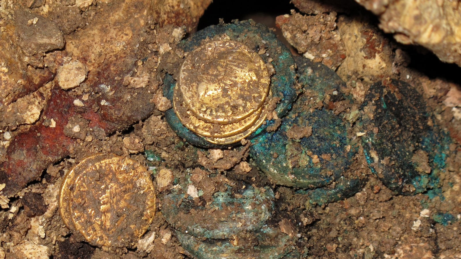
A deep irony underlies the petition. The village sits on the site of the Judean fortress town of Beitar (or Bethar), where Shimon Bar-Kochba, the leader of the second Jewish revolt against Rome (132-135 AD), made his last stand and died. In the 1980s, Israeli archeologists identified the remains of the citadel and found some Bar-Kochba coins on the hillock called by the local Arabs "Khirbet al-Yahud" (the Jewish ruins) three hundred yards west of the village center, and found the remains of the Roman siege wall and two of the besiegers’ camps. A rock next to one of Battir’s springs has an etched inscription (“Leg V Mac et XI Cl”) identifying the legions, the Fifth Macedonica and Eleventh Claudia, that took part in the siege of Beitar. Presumably Battir’s terraces and water canals were first built by the Jewish inhabitants of the land more than two millennia ago.

The issue is currently before the Israeli courts, which must rule whether the planned route of the fence, just north of the village, which lies three miles west of Bethlehem, will do irreparable harm to the ancient system of terraces and canals that irrigate the village’s olive trees and vegetable gardens on the slopes. This is one of the few places in the West Bank where the ancient terrace-canal system has survived.
The planned Battir section of the fence would run more or less along the Green Line or border demarcated in the 1949 Israel-Jordan General Armistice Agreement – but would cut the villagers off from at least 160 acres of their lands inside pre-1967 Israeli territory that they have cultivated since 1949 by special dispensation. Battir overlooks the Tel Aviv-Jerusalem railroad line, and Israel—in the person of then Jerusalem District Commander Moshe Dayan—agreed to allow the villagers to continue to cultivate their cross-border tracts if they took care not to sabotage the railway. This cultivation arrangement was continued after the 1967 Israeli conquest of the West Bank in the Six Day War.
Israel began constructing the fence in 2002, during the Second Intifada or Palestinian rebellion, to block Arab suicide bombers making their way from the West Bank’s towns and villages into Israel, where they regularly blew themselves up in buses and restaurants. Because of technical difficulties, costs and legal challenges by border-hugging Palestinian villagers and townspeople, only some two-thirds to three-quarters of the old border between pre-1967 Israel and the West Bank has so far been fenced—but the parts already built without doubt have greatly contributed to keeping out the terrorists and keeping Israelis secure.
The fence and its still uncompleted sections largely follow the contours of the 1967 border but leave on the Israeli side of the line some seven percent of the West Bank’s land mass, in order to incorporate in the Jewish state the border-hugging large settlement concentrations, such as the Etzion Bloc and Beitar Elit in the southern West Bank, and a handful of strategic hills. The Arabs charged that the "Wall" or fence was designed to steal their lands.
It is quite probable that then Prime Minister Ariel Sharon viewed the prospective contours of the security fence as the future Israeli-West Bank frontier, to which Israel would withdraw either through an agreement with the Palestinians or, without agreement, unilaterally. In 2005 Sharon unilaterally pulled the IDF out of the Gaza Strip (and uprooted all the Israeli settlements in that territory)—and observers at the time believed that he intended to carry out a similar unilateral pullback from the bulk of the West Bank should the two sides fail to reach a negotiated bilateral peace.
Last year UNESCO accepted “Palestine” as its 195th member state and awarded Battir a “Safeguarding and Management of Cultural Landscapes” award. A front-page article on the subject in the Israeli daily Haaretz on 30 May failed altogether to mention that Battir and its terraces had any connection to the Jewish past or Bar-Kochba. No mention of Beitar.
The fall of Beitar in 135 AD was a traumatic event in Jewish history, and is referred to repeatedly in the Talmud and the rabbinic homilies of the First Millennium. According to one such homily, Hadrian, the Roman emperor, “slew eighty thousand … human beings at Bethar …They slew the inhabitants until the horses waded in blood up to the nostrils, and the blood rolled along stones of the size of forty se'ah [a measure] and flowed into the sea [staining it for] a distance of four miles." The second-third century Roman historian, Dio Cassius, wrote that the Romans slew 580,000 men in crushing the Bar-Kochba Revolt, while others died of disease and famine. Many legionnaires apparently died as well, because Dio Cassius records that Hadrian, in reporting his victory over the rebels to the Senate, refrained from employing the customary opening: "I and the legions are in health."
Perhaps Israel should petition UNESCO to recognize Beitar as a world heritage site, fence or no fence.